
![2009 [BADGE].png](https://static.wixstatic.com/media/1a0618_96d254a72f314d68bd1d560123383b05~mv2.png/v1/crop/x_0,y_116,w_1667,h_1436/fill/w_137,h_118,al_c,q_85,usm_0.66_1.00_0.01,enc_avif,quality_auto/2009%20%5BBADGE%5D.png)
Eliburn Reservoir and Livingston Village
- William Weir
- Feb 9
- 4 min read
The sun has yet to breach the horizon and it’s bitterly cold, a thin layer of snow covering the ground, as I make my way across the park from Livingston FC Community Club towards the reservoir.
It’s not long before I reach the water’s edge, but instead of the waterlily patchwork of summer I am met with a three-acre expanse of ice, product of the past week’s freezing temperatures. In that moment, I realise that today my search for the usually abundant water birds may be in vain.
Created in the 1970s, Eliburn Reservoir acts as both a flood prevention measure and a water source for the town of Livingston. It’s also home to a variety of wildlife and is a popular course fishing site, stocked with trout, carp and other species. And it’s as I round a corner approaching one of the numerous fishing platforms that I encounter a wonderful sight that makes my morning.
The entire reservoir is not frozen over after all. At the edge of a triangular inlet, an area roughly twenty metres by ten is free of ice and within it are congregated the reservoir’s entire population of waterfowl. The contrast with the otherwise deserted icesheet is stark. Today, this is The Centre of Livingston’s bird world. There are adult swans, impossibly white, accompanied by two immature birds - last year’s cygnets. There are ubiquitous mallards too, tufted ducks dapper in white and jet black, coots, moorhens, and the diminutive dabchicks (little grebes) who dive shyly below the surface when I first appear.


The swans are the chief icebreakers of this collective; they have the weight and strength to break through the newly frozen surface before the ice becomes too thick. Drawn by these openings and the need to feed, other species follow suit and it is only by their continual movement that the surface remains ice free. There’s certainly much motion this morning. Ducks dabble back and forth, periodically hauling themselves up on to the edge of the ice to shake and preen. A coot high-steps across the ice on large, lobed feet, like a snorkeler who has forgotten to remove his flippers. One of the young swans tests its wings enthusiastically with a great whooshing of air.
After a while I pull myself away from this engaging scene and continue onwards. Past the dam at the reservoir’s western end the terrain drops away, and the path descends into pinewoods. A woodpecker drums somewhere in the tops. I make my way down through the trees to pick up the Lochshot Burn path. It’s easy walking along this well-made path, accompanied by relaxing babbling of the burn. Within one curve of the waterway stand nine mysterious snow-dusted figures, waiting in the cold - the Livingston Stone Circle, a modern take on the neolithic.
Where the burn flows into the River Almond I bear left and continue along the river in pleasantly wooded surroundings, stopping on my way to admire the delicate almond-rose hues of a female bullfinch in the overhanging branches. Soon I reach a bridge, which extends Livingston Village’s Main Street across the river. Glancing up to my left I see the historic Livingston Inn and saunter up for a closer look. The Inn dates from c1760 and Robert Burns is reputed to have stayed here. From here you can walk along Main Street and rejoin the river path, accessed just after Bloom Place. The trail then passes through the elongated expanse of Livingston Village Park where the trees on all sides are alive with the calls of a host of winter birds - goldfinch, blue tit, great tit, coal tit and robin. Towards the eastern end of the park, I track away from the water, picking up the Alderstone Path which skips north past the Geddes House business centre where I turn west, making for Cousland Road. Passing briefly through Cousland Woods and a residential street I follow a sign for the Folly Burn path, spiralling up and over a footbridge then on to Peel Park.
Peel Park takes its name from the original Peel of Livingston, a moated, fortified tower house dating back to the 12th century. All that now remains is a grassy mound marking the site. Adjacent are the ruins of Livingston House which stood here from the 17th to 19th centuries. Today, snow lies upon the cracked and weathered walls, or what’s left of them. I wander through the ruin, pausing in front of the old hearth. In my mind’s eye I am transported back three hundred years to a dark, cold January day when the fire roaring within would have been a welcome sight for the returning residents. Perhaps even Burns himself may have come to call?
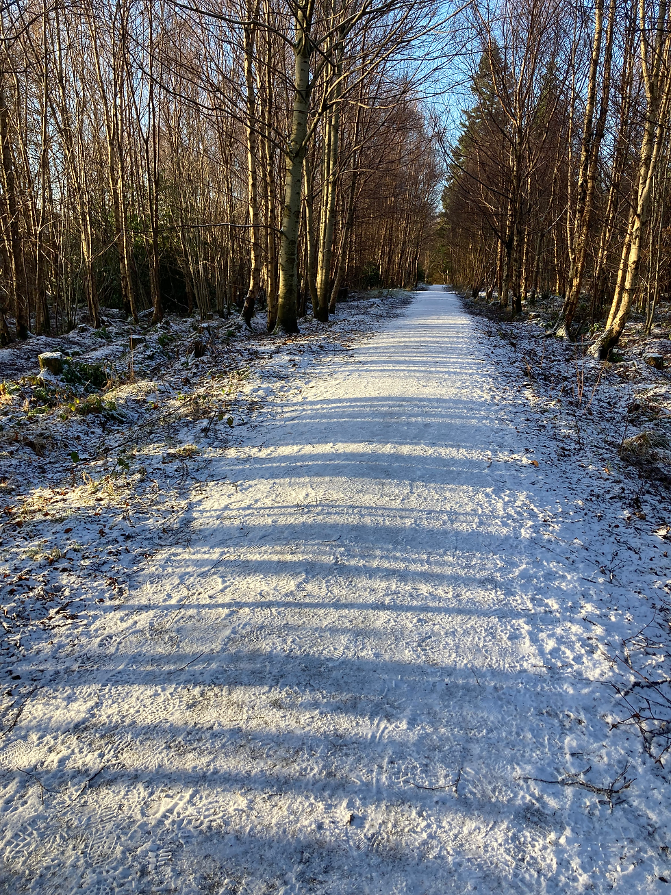
I cross the Folly Burn, following a path northwest beneath Eliburn Road and through some residential streets to join Kirk Road Strip running west. This leads me into Old Livingston Wood. It’s mid-morning now and the sky has cleared to azure blue. The low sun shines through bare birches, casting long shadows across the path, alternating with white snow like one long bar code. Soon, I’m back at the reservoir’s eastern shore. Glancing across the ice, I notice a family now feeding the ducks and swans and, smiling, return to my starting point.
Allow 1.5 – 2 hours (6 km), all paths are well surfaced.

Published in Konect February 2026
Author: William Weir
All photos by William Weir

Comments